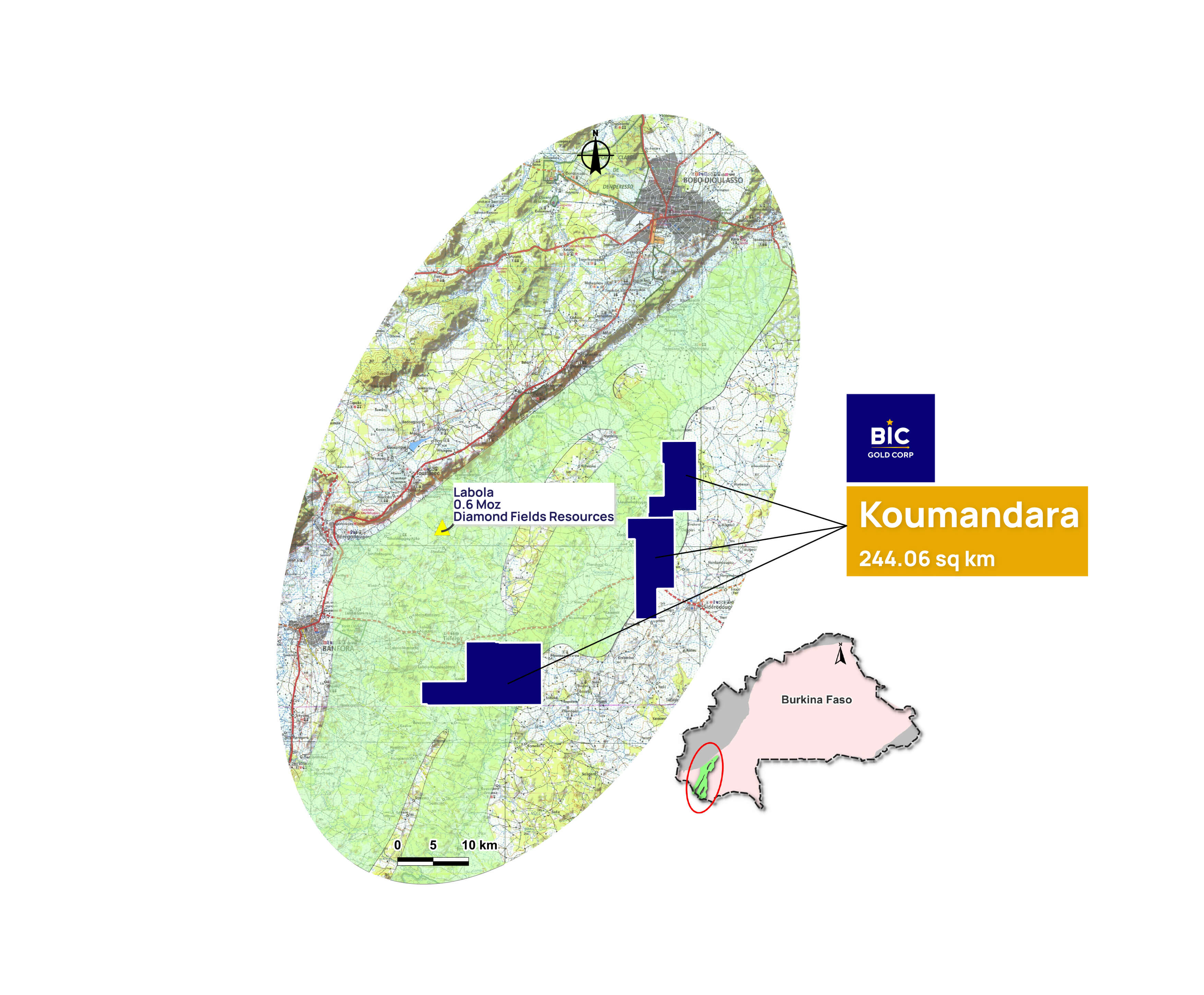
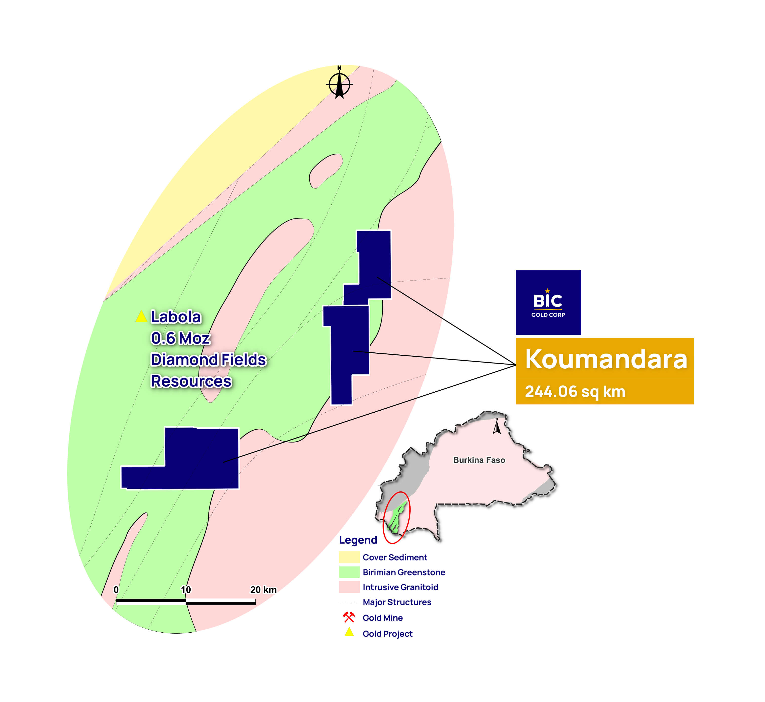
Koumandara Gold Project
Project LocationThe Koumandara Project is situated in southwestern Burkina Faso and comprises three permits: Dabokuy, Noumousso, and Kongoroba. Dabokuy and Noumousso are located 47 km south of Bobo-Dioulasso, while Kongoroba is positioned 70 km south of Bobo-Dioulasso along the Sideradougou-Banfora road.
BIC has recently acquired Sarama Faso SARL, the company that holds the Koumandara Project.
Project Area
244.06 sq km
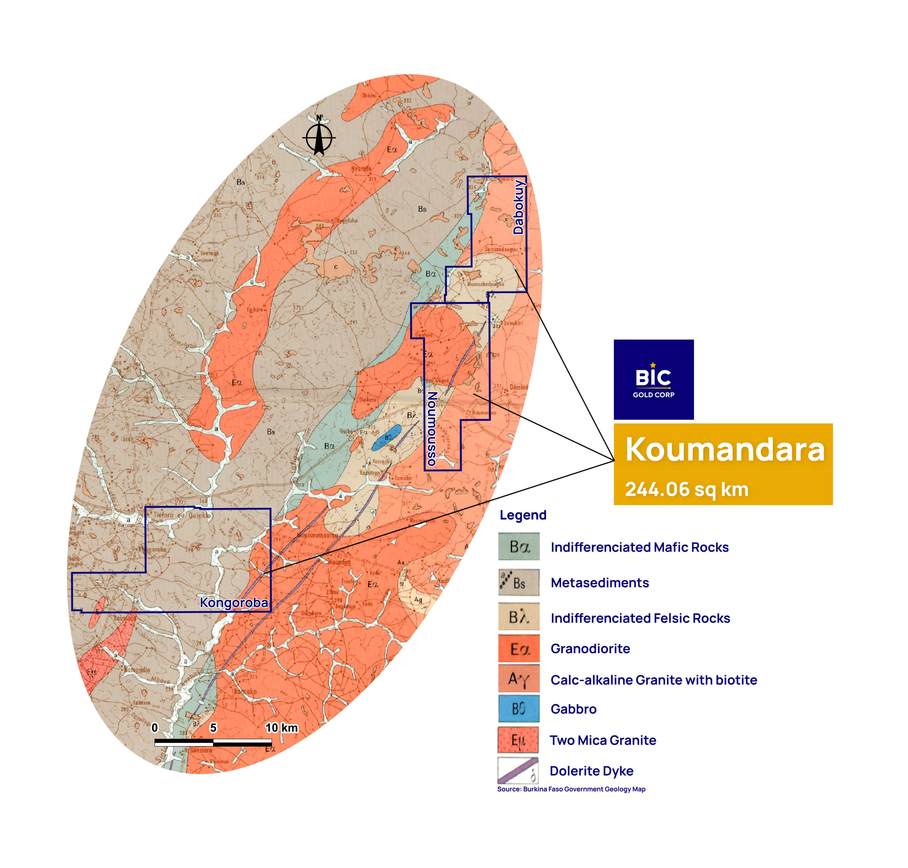
Dabokuy: The northwestern part of the concession is characterized by the presence of supracrustal rocks (meta tuffs, pyroclastics, mafic flows and small bodies of diorite), while the remainder of the area is predominantly underlain by granitic rocks, mainly granodiorite.
Noumousso: Geologically the permit is located along the eastern margin of the Birimian Banfora greenstone belt. The rock types occurring within the permit are metasediments, metavolcanics, syn-volcanic mafic to intermediate plugs and intrusive granites.
Kongoroba: The south eastern part of the permit comprises of granitic rocks; remaining part of the permit is covered by supracrustal rocks.